Caribbean Birding Trail

Know the Caribbean, Bird by Bird

Donate
  • About the CBT
    • Interpretive Guide Training
  • Countries
    • Countries A-I
      • Anguilla
        • Cove Pond
        • Dog Island
        • East End Pond
        • Forest Bay Pond
        • Katouche Canyon
        • Long Pond
        • Meads Bay Pond
        • Merrywing Pond System
        • Prickly Pear Cays
        • Road Salt Pond
        • Scrub Island
        • Sombrero
        • West End By-the-Sea Ponds
        • West End Pond
      • Antigua and Barbuda
        • Bethesda Dam
        • Christian Valley
        • Codrington Lagoon
        • McKinnon’s Salt Pond
        • Two Foot Bay National Park
      • Aruba
        • Spaans Lagoon
      • Bahamas
        • Abaco
        • Andros
        • Cat Island
        • Crooked Island and Acklins
        • Eleuthera
        • Exumas
        • Grand Bahama
        • Great Inagua
        • Long Island
        • Mayaguana
        • New Providence
        • San Salvador
      • Barbados
      • Bonaire
        • Dos Pos IBA
        • Gotomeer
      • British Virgin Islands
        • Josiahs Bay Salt Pond
        • Sandy Cay
      • Cuba
        • Guanahacabibes
        • Humboldt National Park
        • Mensura-Piloto National Park
        • Viñales
        • Zapata Swamp
      • Curaçao
        • Christoffel National Park
        • Salt Pans of Jan Thiel
      • Dominica
      • Dominican Republic
        • Central Mountain Range
          • Constanza and Valle Nuevo
          • Ebano Verde Reserve
          • Hatillo
          • Jarabacoa with Armando Bermúdez and José del Carmen Ramírez National Parks
          • La Joya de San Francisco
          • Loma Quita Espuela
          • Pico Diego de Ocampo, Santiago
        • Southeast
          • Bávaro
          • Cumayasa
          • Del Este National Park
            • Del Este National Park: Boca de Yuma
            • Del Este National Park: Guaraguao
            • Del Este National Park: Padre Nuestro Trail
            • Del Este National Park: Saona Island
          • Ecological Foundation Trail, Punta Cana
          • Limón Lagoon
          • Los Haitises National Park
            • Los Haitises National Park: Caño Hondo
            • Los Haitises National Park: Los Limones
          • Monte Plata
        • Southwest
          • Aguacate and Zapotén
          • Cabo Rojo and Pedernales
          • Cabral Lagoon
          • Cachote, Eastern Bahoruco
          • Jimaní
          • Lake Enriquillo
          • Loma Charco Azul
          • Oviedo Lagoon, Jaragua National Park
          • Puerto Alejandro and Tortuguero
          • Rabo de Gato and Puerto Escondido
          • Sierra de Bahoruco National Park
            • Los Arroyos, Sierra de Bahoruco National Park
        • North Coast
          • Cayos Siete Hermanos
          • El Choco National Park, Cabarete
          • El Limón, Samaná
          • Estero Hondo
          • Loma Guaconejo
          • Loma Isabel de Torres, Puerto Plata
          • Monte Cristi and Saladilla
          • Nalga de Maco National Park, Río Limpio
          • Samaná
        • Around Santo Domingo
          • Las Salinas de Baní
          • Mirador del Norte Park
          • National Botanical Garden
          • Ozama Wetlands
      • Grenada
        • Antoine Lake
        • Beausejour/Grenville Vale
        • Diamond Rock
        • Grand Etang National Park
        • Levera National Park
        • Mt. Hartman National Park
        • Telescope Pond
        • Woburn Bay MPA
      • Guadeloupe
        • Mountain Road
        • Pointe des Chateaux
    • Countries J-Z
      • Jamaica
        • Ahhh…Ras Natango Gallery and Garden
        • Barbecue Bottom Road
        • Black River Great Morass
        • Cockpit Country
        • Ecclesdown Road
        • Flagstaff
        • Green Hills Field Station
        • Hardwar Gap
        • Hope Gardens
        • Portland Bight Protected Area
        • Stewart Town
      • Martinique
        • Rocher du Diamant
      • Montserrat
      • Puerto Rico
        • Camuy Coastal Area
        • Culebra National Wildlife Refuge
        • Laguna Cartagena National Wildlife Refuge
      • Sint Eustatius
        • Pilot Hill
        • Quill/Boven National Park
        • Zeelandia Beach
      • St. Lucia
      • Sint Maarten
        • Great Salt Pond
        • Little Bay Pond
      • St. Martin
        • Amuseum Naturalis at The Old House
        • Étang Cimetière de Grand Case
        • Étang de la Barrière
        • Pic Paradis
      • St. Vincent and the Grenadines
        • Grenadines
          • Bird Sanctuary
          • Mustique Lagoon
          • Mustique Ponds Walk
        • Saint Vincent
          • Richmond Beach
      • Trinidad and Tobago
        • Tobago
          • Kilgwyn Swamp
          • Little Tobago
        • Trinidad
          • Asa Wright Nature Centre
          • Brasso Seco Paria Village
      • Turks and Caicos
        • Grand Turk
        • Middle Caicos
        • North Caicos
        • Providenciales
        • Salt Cay
        • South Caicos
  • Tours
  • Guides
  • Get Involved
  • Contact Us

You are here: Home / Dominican Republic / Southwest / Sierra de Bahoruco National Park

Sierra de Bahoruco National Park

  • About
  • The Birds
  • Where to Stay

The Sierra de Bahoruco is the southern-most mountain range on Hispaniola, located in southwest Dominican Republic. The range is part of the Massif de la Selle-Jaragua-Bahoruco-Enriquillo Bi-national Corridor. The vegetation is a diverse array of forest types across a wide variety of life zones. The area is also an Important Bird Area, supporting 32 (of the 34) Hispaniolan Endemic Bird Area restricted range species.

Created in 1983, the National Park spans 112,448 ha (277,964 acres) and contains several good locations for birding on the northern and southern slope of the Sierra.

Southern Slope of Sierra de Bahoruco
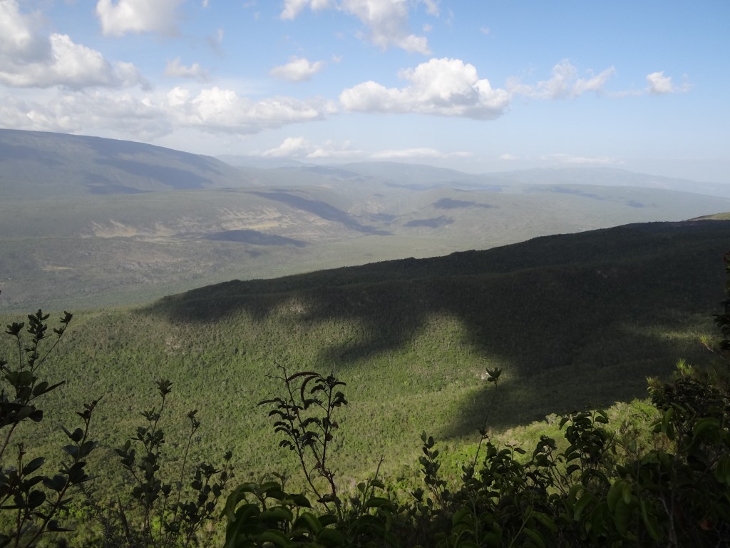
The southern slope of the Sierra de Bahoruco National Park is served by an excellent paved road that was built by the Alcoa company for bauxite mining operations. The Alcoa road climbs steadily from sea level through dry broadleaf forests, until reaching the now inactive open pit mines near Las Mercedes and a national park entrance gate. Beyond the gate, the road continues to gain elevation, reflected in the changing habitat. The broadleaf forest becomes moist and then transitions into pine forest at about 1,100 meters in elevation.

After passing the park’s entrance gate near Las Mercedes, look for small white kilometer markers on your right. At kilometer 19 (365 m elevation), a walking trail to the right can be followed well into classic dry forest habitat to look for Limpkin, Key West Quail-Dove, Hispaniolan Lizard-Cuckoo, Hispaniolan Pewee, Black-whiskered Vireo, Stolid Flycatcher, and Green-tailed Ground-Tanagers.

At kilometer 26 (745 m elevation), look for another entrance on the left which descends into a very nice moist broadleaf canyon. Here you may find White-fronted Quail-Dove, Ruddy Quail-Dove, both the Hispaniolan and Olive-throated parakeets, Narrow-billed Tody, Red-legged Thrush, and Antillean Euphonia. Bicknell’s Thrush has also been recorded here in winter months.

Continuing on the Alcoa road you enter the pine zone, and just after kilometer 30, look for a national park sign for La Charca. Look for Hispaniolan Emerald, Antillean Piculet, Caribbean Martin, Greater Antillean Elaenia, and especially Golden Swallow and Hispaniolan Crossbill, as well as several species of warblers in season. The Hispaniolan Parrot, Plain Pigeon, and Palm Crow are also frequently seen here.

Once well-into the pine zone, the road again levels off and the road forks. Straight ahead is a locked gate and to the right is another gate. An entrance fee is collected for those continuing on to the Hoyo de Pelempito Visitor Center. This is another place to look for the Hispaniolan Crossbills, as they come in to drink. The visitor center lies 10 km (6.2 miles) further on at the end of this road. This is a favorite spot to view Hispaniolan Parrots in the late afternoon. And if you happen to be returning down the Aceitillar road, listen carefully for the calls of the Limpkin and Hispaniolan Nightjar, and the eye-shine of the over-wintering Chuck-will’s-widow.

Hoyo de Pelempito (Photo by Ted Lee Eubanks)

Northern Slope of the Sierra de Bahoruco
The Puerto Escondido area and the Rabo de Gato trail are some of the premier birdwatching areas on the northern slope of the Sierra de Bahoruco mountain range.

The Hispaniolan Lizard-Cuckoo, Antillean Piculet, and Hispaniolan Oriole are all common, and both species of Tody, Narrow-billed and Broanates at Villa Barrancolí, located just outside of Puerto Escondido.

From Puerto Escondido, you can opt to continue exploring the north slope of the range by heading to Aguacate and Zapotén. Beginning above Zapotén, this is the best site for high-elevation endemics such as the Scaly-naped Pigeon, White-fronted Quail-Dove, Hispaniolan Highland-Tanager, Hispaniolan Trogon, Green-tailed Ground-Tanager, Watern Chat-Tanager, Antillean Siskin, La Selle Thrush and more.

Aguacate is a moist broadleaf site and near the beginning of the cloud-forest zone. The Loggerhead Kingbird is frequently seen here, and it’s also a good place to look for endemic Hispaniolan Parakeets and the common Olive-throated Parakeet.

Target species include Sharp- shinned Hawk, Limpkin Zenaida Dove, Key West Quail- Dove, White- fronted Quail- Dove, Ruddy Quail- Dove, Olive- throated Parakeet, Black- billed Cuckoo, Bay- breasted Cuckoo, Ashy- faced Owl, Burrowing Owl, Stygian Owl, Chuck- will’s- widow, Hispaniolan Nightjar, Northern Potoo, Black Swift, White- collared Swift, Hispaniolan Emerald, Hispaniolan Trogon, Antillean Piculet, Yellow- bellied Sapsucker, Greater Antillean Elaenia, Hispaniolan Pewee, Loggerhead Kingbird, Black- whiskered Vireo, Hispaniolan Palm Crow, Tree Swallow, Golden Swallow, Bicknell’s Thrush, Magnolia Warbler, Black- throated Blue Warbler, Yellow- rumped Warbler, Black- throated Green Warbler, Yellow- throated Warbler, Green- tailed Ground- Tanager, Hispaniolan Spindalis, Black-faced Grassquit, Rose- breasted Grosbeak, Antillean Euphonia, Hispaniolan Crossbill, Antillean Siskin

Villa Barrancolí’s close proximity to the Sierra de Bahoruco National Park makes it an ideal base camp for exploring the northern slope of the Sierra. One can begin by taking the Rabo de Gato trail, a 1-2 hour walk (depending on how good the birdwatching is!) starting at Villa Barrancolí.

The trail leads into riparian woods with a variety of plants and large trees. Those interested in plants, butterflies and birds will enjoy this habitat. All but two of the 32 bird species endemic to Hispaniola may be found in the Sierra de Bahoruco.

Broad-billed Tody (Photo by Ted Eubanks)

Villa Barrancolí is also at the beginning of the international highway (4×4 necessary), leading to Aguacate on the Haitian border and to Zapotén’s cloud forest. The road then continues on to Pedernales.

The Villa is owned and operated by Kate Wallace, who first came to the Dominican Republic as a Peace Corps volunteer in the 90’s. As a former teacher/naturalist with the Massachusetts Audubon Society, she quickly discovered the interesting variety of birds and soon joined a group of birders exploring the wild areas of the country. Part of her work was developing educational materials in parts of the country close to the national parks in the southwest and, in the process, she came to appreciate the opportunities available to visiting birdwatchers.

After the end of her service with Peace Corps, having fallen in love with the country’s flora and fauna, she decided to stay in the country to continue working with community groups and bird conservation. She began guiding in 1997 and has been active as a guide ever since, operating Tody Tours, which specializes in southwestern Dominican Republic. Kate is also active with the Sociedad Ornitológica de la Hispaniola and the Society for the Conservation and Study of Caribbean Birds.

Villa Barrancolí is equipped with five screened cabins with two beds in each. There is a bath house with hot showers and a common dining area. Meals can be arranged if desired.

Guest Cabin
Dining Area

Access
From the town of Barahona, take the main road north toward Santo Domingo until reaching a major intersection and the raod to Cabral, Duverge, and Jimani. Turn left and continue to Duverge (about one hour driving time). In Duverge look for signs for a left turn to Puerto Escondido. If you miss the sign, the turn is the fifth left after the gas station in town. Follow this road southward as it leaves town and seeon becomes dirt. Follow a small river bottom, and then steadily climb along an aqueduct through dry and dusty hills until reaching the small village of Puerto Escondido. The National Park house is on the right as you enter the village. Stop here to get a ticket for the park.

Continue straight through town until reaching a T-intersection. To reach Villa Barrancolí, and Rabo de Gato, turn left at the T and go past a chain-link fence surrounding the dam buildings. You will then turn right, cross a canal, and take the next right at a sign for Rabo de Gato.  Villa Barrancolí will be on your left.

Visit the website for more information: www.todytours.com/villabarrancoli.html

Sierra de Bahoruco National Park

Dominican Republic Sites

Constanza and Valle Nuevo

Ebano Verde Reserve

Hatillo

Jarabacoa with Armando Bermúdez and José del Carmen Ramírez National Parks

La Joya de San Francisco

Loma Quita Espuela

Pico Diego de Ocampo, Santiago

Bávaro

Cumayasa

Del Este National Park: Boca de Yuma

Del Este National Park: Guaraguao

Del Este National Park: Padre Nuestro Trail

Del Este National Park: Saona Island

Ecological Foundation Trail, Punta Cana

Limón Lagoon

Los Haitises National Park: Caño Hondo

Los Haitises National Park: Los Limones

Monte Plata

Aguacate and Zapotén

Cabo Rojo and Pedernales

Cabral Lagoon

Cachote, Eastern Bahoruco

Jimaní

Lake Enriquillo

Loma Charco Azul

Oviedo Lagoon, Jaragua National Park

Puerto Alejandro and Tortuguero

Rabo de Gato and Puerto Escondido

Los Arroyos, Sierra de Bahoruco National Park

Cayos Siete Hermanos

El Limón, Samaná

Estero Hondo

Loma Guaconejo

Loma Isabel de Torres, Puerto Plata

Monte Cristi and Saladilla

Nalga de Maco National Park, Río Limpio

Samaná

Las Salinas de Baní

Mirador del Norte Park

National Botanical Garden

Ozama Wetlands

Partners in the Dominican Republic

  • Grupo Acción Ecológica
  • Grupo Jaragua
  • La Sociedad Ornitológica de la Hispaniola (SOH)
  • National Aviary

With special thanks to our partners at the Ruta Barrancoli

Ruta Barrancoli logo


Dominican Republic Tour Operators

  • Cúa Birding
  • Explora Ecotour
  • Kirkconnell Birds Conservancy
  • Miguel A. Landestoy T., Independent Guide
  • Tody Tours
  • Wildside Nature Tours

Bird Checklists

Click here to download a pamphlet-sized year-round checklist for Dominican Republic.

Recommended Field Guides

Field Guide to the Birds of the Dominican Republic and Haiti by Steven Latta, Christopher Rimmer, and Kent McFarland

Field Guide to the Birds of the Dominican Republic and Haiti

Aves de la República Dominicana y Haití by Steven Latta, Christopher Rimmer, Allan Keith, James Wiley, Herbert A. Raffaele, Kent McFarland, and Eladio Fernandez

Ruta Barrancolí: A Bird-finding Guide to the Dominican Republic by Steven C. Latta and Kate J. Wallace

Birds of the West Indies by Herbert Raffaele, James Wiley, Orlando Garrido, Allan Keith, and Janis Raffaele

Want to know how you can be involved?

Do you know of a place that should be part of the Caribbean Birding Trail? Are you the owner of a lodge or hotel and want to attract eco-tourists? Are you a guide interested in the birdwatching market? Then, get involved with our project!

Get Involved

The Latest from BirdsCaribbean.org

Twitter
Birds Caribbean
Birds Caribbean
@BirdsCaribbean

The Barbados-based dynamic birding & #travel experts✈️, Ryan and Alex Chenery of Birding the Islands are crafting tailor-made, multi-island 🏝️ travel itineraries for individuals & small groups. Learn how you can build your own #birding holiday at: bit.ly/Build-your-ow… pic.twitter.com/yEbO…

reply retweet favorite
3:55 pm · June 12, 2023
Twitter
Birds Caribbean
Birds Caribbean
@BirdsCaribbean

Endemic Bird of the Day, Day 126! 🦩🦜🦉 The small but feisty Flat-billed Vireo! 🇩🇴🇭🇹 For feathery facts and materials: bit.ly/FlatbilledVir… #CEBF2023 #FromTheNest #WaterSustainingBirdLife @grupojaragua @accionverde @SOSAmbienteRD @TurismoRD @Trees4Haiti @LoopHaiti pic.twitter.com/XwpI…

reply retweet favorite
3:35 pm · June 11, 2023
Twitter
Birds Caribbean
Birds Caribbean
@BirdsCaribbean

Join experienced tour guide Ernesto Reyes🇨🇺 on an extraordinary trip to #Colombia! For the detailed itinerary head over to: bit.ly/BirdTourColom… ✨For every BirdsCaribbean person that signs up for this trip, Ernesto will make a $100 donation to us! 📸Carlos Roberto Chavarria pic.twitter.com/Blco…

reply retweet favorite
7:52 pm · June 9, 2023
Twitter
Birds Caribbean
Birds Caribbean
@BirdsCaribbean

#ExpeditionDiablotin was a challenging search for the Black-capped Petrel in #Dominica. But also a rewarding experience connecting with locals to build support for its conservation. Learn more at: bit.ly/DiablotinOutr… @ABCbirds @EPICislands @SeabirdEcology @USFWS @jlkbrisbane pic.twitter.com/DBqF…

reply retweet favorite
2:25 pm · June 8, 2023
Twitter
Birds Caribbean
Birds Caribbean
@BirdsCaribbean

Endemic Bird of the Day, Day 125! 🦉🦜🦩 A spectacularly colorful Cuban endemic: the Gray-fronted Quail-Dove! 🇨🇺 For feathery facts, puzzles, coloring page & more: bit.ly/GrayFrontedQu… #CEBF2023 #FromTheNest #WaterSustainingBirdLife @BirdingEastCuba @AMA_CUBA pic.twitter.com/WgnQ…

reply retweet favorite
3:20 pm · June 7, 2023

Our Site

  • Home
  • About the CBT
  • Countries
  • Tours
  • Guides
  • Get Involved
  • Contact

Search

Follow

Sign up for our Mailing List

Copyright © 2011–2025 Caribbean Birding Trail. A project of BirdsCaribbean.